DGPE Faculty Part of Project Mapping COVID-19 Trends in ENC
The Department of Geography, Planning, and Environment (DGPE) faculty were part of a collaboration in 2021 between ECU, Vidant Health, and Dartmouth College to map spatiotemporal COVID-19 trends in Eastern North Carolina (ENC). The project was supported by the North Carolina General Assembly via the COVID-19 CARES Act Research Fund. Dr. Yoo Min Park (co-PI on the project) and Rob Howard (Co-Director, ECU Center for GIS) worked to develop a web hub (ENCHealth.org) where people can find:
- Cases/death overview dashboard that is updated daily
- Information about vulnerable and high-vaccine-priority populations in eastern North Carolina
- A “Daily COVID Weather Forecast Map” to predict the future rate of COVID-19 cases in each county in ENC
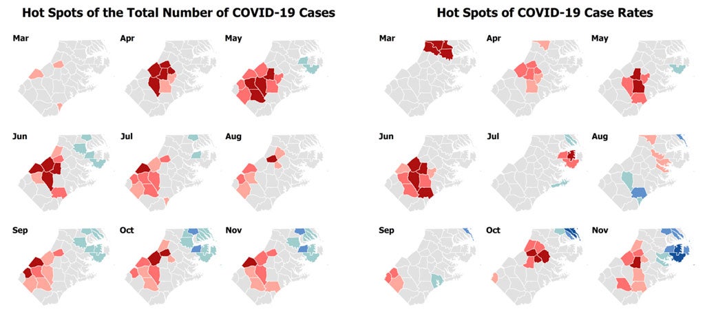
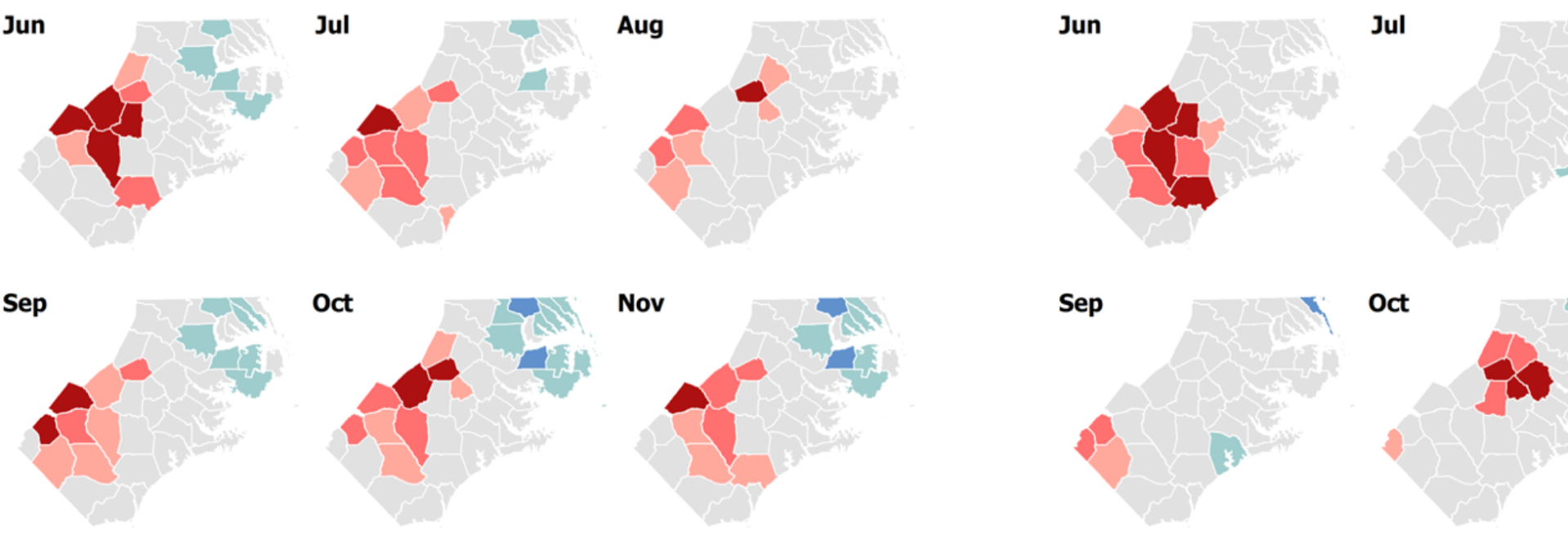
- Hot spot analysis results to identify where high number of COVID-19 cases/deaths or high rates cluster spatially
- Information about policy and practice
Dr. Park did critical work on the hot spot analysis whereas Mr. Howard contributed to developing the web mapping tool for the Vaccine Priority Index and led the complex Institutional Review Board (IRB) and HIPAA-related approval process. Dr. Park shared that they named the web hub as ‘ENC Health’, instead of a COVID-specific name, as they anticipate expanding the scope of the web hub to include information about other health and diseases in the future for the ENC region. Follow the link for more information about the project.